Logo

Contact Phone

Our Office are open 07AM - 22PM

Monday - Friday

Web Map Service

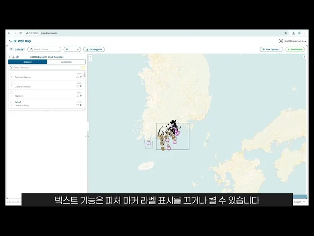
S-100 Web map is a web mapping platform for creating, managing, visualizing, and validating S-201 data using the S-100 Feature Catalogue (FC) and Portrayal Catalogue (PC). Users can upload existing GML data or create new datasets and export completed work as GML or a standards-based Exchange Set.

S-100 Viewer interface

Web Map Service

S-100 Web map is a web mapping platform for creating, managing, visualizing, and validating S-201 data using the S-100 Feature Catalogue (FC) and Portrayal Catalogue (PC). Users can upload existing GML data or create new datasets and export completed work as GML or a standards-based Exchange Set.

S-100 Viewer interface

Web Map Service

S-100 Web map is a web mapping platform for creating, managing, visualizing, and validating S-201 data using the S-100 Feature Catalogue (FC) and Portrayal Catalogue (PC). Users can upload existing GML data or create new datasets and export completed work as GML or a standards-based Exchange Set.

S-100 Viewer interface
Awebmappingplatformforcreating,managing,visualizing,andvalidatingS-201databasedontheS-100FCandPC.
works image
Dataset Upload & Creation

Creates a blank dataset using selected FC and PC resources or builds a working dataset by uploading an existing GML file, providing a standards-based starting point for data production and testing.

FC-Based Feature Management

Creates and edits features according to the objects, attributes, and associations defined in the Feature Catalogue, allowing users to verify data modelling against the standard structure.

works image
works image
PC Symbol Style Application

Connects the FC and Portrayal Catalogue to apply symbols, colors, and portrayal rules to features, enabling data structure and visual presentation to be tested together.

FC-Based Data Validation

Checks dataset features and attributes against the Feature Catalogue, helping users identify structural errors and review data quality and conformance.

works image
works image
Dataset & Exchange Set Download

Exports completed work as a GML dataset or standards-based Exchange Set, allowing validated data to be used in external systems and subsequent workflows.

Web Map Data Visualization

Visualizes S-201 spatial data on an interactive web map and displays feature locations and attributes, allowing users to review FC-based data structures and PC-based portrayal results in one environment.

works image

FAQs

Who is S-100 Web map designed for?

It is designed for hydrographic offices, Aids to Navigation authorities, research institutes, and teams working on S-100 standard development or validation. It is especially useful when multiple users need to work with data and standard catalogues in a shared web environment rather than through separate desktop tools.

Which S-100 data product is currently targeted?

Do users need to install a separate application?

Can organization-specific FC/PC resources or additional requirements be applied?

Advancing maritime digitalization through
S-100 standards and technology.

+82 42-710-7022

Logo

Advancing maritime digitalization through
S-100 standards and technology.

+82 42-710-7022

Logo

Advancing maritime digitalization through
S-100 standards and technology.

+82 42-710-7022

Logo